MegaScenery Earth – Colorado Complete State
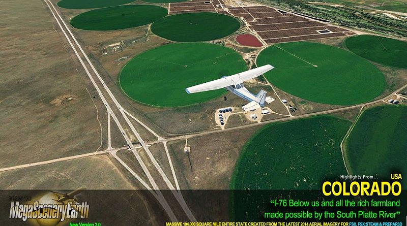
The New MegaSceneryEarth Colorado 3 featuring unsurpassed image sharpness, scenery color and clarity, improved scenery features with accurate additional water bodies and topographical data and the latest aerial imagery available taken in 2014.
Colorado is over 104,093 square miles in size and has 272 airports. You’ll see everything that you see in Colorado in real life in the scenery.
Colorado is a visually spectacular and fun place to fly with Rocky Mountain terrain with towering mountain peaks above 14,000 feet. Average elevation of Colorado is 6,800 feet, higher than any other state. This kind of terrain is where MegaSceneryEarth 2.0’s high res graphics really shine. You’ll be truly stunned by the scenery of Colorado.
As an added bonus, we now provide all the VFR and IFR charts in digital PDF format to enable you to get the most out of your scenery. This includes 3 Sectionals, 2 Terminal Area Charts, 5 IFR enroute charts, and a 477 page book of Instrument Approach plates, Airport Diagrams, SIDs and STARs, and an Airport Facility Directory. The charts are downloadable along with your scenery files.
Some of the cities and landmarks you’ll get to enjoy as you explore Colorado include:
Cities: Denver, Colorado Springs, Aurora, Lakewood, Fort Collins, Arvada, Boulder
you can buy clicking the image at fspilotshop.com: